Day Hikes near Tbilisi: Kojori, Tbilisi National Park and Shaori Fortress
Tbilisi is ringed by forested hills, and some of the best walking near the city starts with a 1 GEL bus ride from Freedom Square. Here's what you need to know about the day hikes near Tbilisi: the trails I'd pick, how long each one takes, how to reach them without a car, and which famous hikes are too far away for a day.
Day hikes near Tbilisi at a glance
Nine hikes, from the closest to the farthest. The first three start on a cable car or a city bus, the national park needs a taxi, and everything below that is a long day with a driver, a van or a tour.
| Hike | Getting there | Length and time | Difficulty | Best for |
|---|---|---|---|---|
| Turtle Lake to Mtatsminda | Cable car from Vake Park, 1 GEL | About 3 hours with stops | Easy | A free morning in the city |
| Kojori to Tbilisi | Bus 380 or 316, 1 GEL, about 45 minutes | 4 to 5 hours, mostly downhill | Easy to moderate | Your first hike near Tbilisi |
| Kojori to Kiketi | The same buses, then a bus back from Kiketi | About 7 km, 2 to 3 hours | Easy | A short half day with waterfalls |
| Saguramo Ridge, Tbilisi National Park | Taxi, about 45 minutes, 30 to 40 GEL | About 11 km return, 4 to 5 hours | Moderate | A proper forest and ridge day |
| Mamkoda to Zedazeni Monastery | Bolt to the monastery | About 15 km, 5 to 6 hours | Moderate to hard | Fit hikers happy off the beaten path |
| Martkopi tower | About 30 minutes east by car | About 15 minutes up to the tower | Easy | A view with almost no walking |
| Gergeti Trinity Church, Kazbegi | Van or driver, 2.5 to 3 hours each way | About 1.5 hours up, about 500 m of climb | Moderate | Big mountains; better with a night |
| Shaori Fortress, Javakheti | Driver or tour, about 2 h 50 each way | About 5 km, about 390 m of climb | Moderate, unmarked | Volcanic plateau and ancient stones |
| Tskhrajvari, Racha | About 1 hour by car from Kutaisi | About 3 km from the pass | Moderate, cliff edges | Your Kutaisi days |
Which hike near Tbilisi to pick
Most people have one free day and no car. Here is how I'd match the hike to the trip:
- First hike, no car: Kojori to Tbilisi. The bus does the climbing, the route ends in the city, and you see a fortress, a monastery and the best view of Tbilisi on the way.
- Only a morning: Turtle Lake to Mtatsminda. If you have just an hour, the uphill paths above the waterfall in the National Botanical Garden give you a short, steep workout behind Narikala for 4 GEL.
- A real forest day: Saguramo Ridge in Tbilisi National Park. It is the closest thing to wilderness within an hour of the center.
- You hike a lot at home: Mamkoda to Zedazeni, or Shaori Fortress with a guide.
- You're going to Kazbegi anyway: walk up to Gergeti instead of riding the 4x4.
And the cases where my answer is no:
- Tskhrajvari as a day trip from Tbilisi. It sits about an hour beyond Kutaisi, so the drive eats the whole day.
- The David Gareja ridge walk to Udabno. It has been closed since 2019, and border guards turn walkers back.
- Shaori in cloud or without someone who knows the way. The trail is faint and the ridge is high and exposed.
- Kazbegi as a hiking day trip in deep winter. The road beyond Gudauri can close after snow, which leaves no margin for a hike.
Turtle Lake to Mtatsminda: a hike inside the city
Turtle Lake is the small lake on the wooded hill above Vake, and an old Soviet ropeway from Vake Park lifts you to it for 1 GEL on a Metromoney card, daily from 10:00. From the lake, marked forest trails follow the ridge across to Mtatsminda, the mountain with the TV tower on top. Allow about 3 hours with stops. It's the easiest hike on this list to fit around a city day: no bus timetable, no taxi, and you finish with the whole of Tbilisi under your feet.
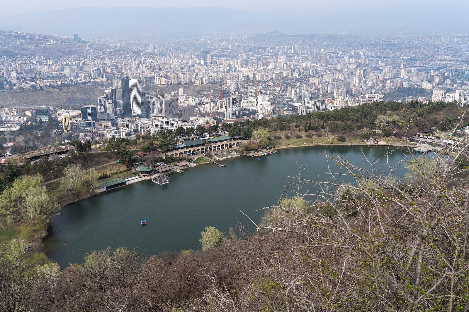
The path runs mostly through woods, with breaks in the trees where the city opens up below. If you have time before you start, the Open Air Museum of Ethnography is about 20 minutes down the road from the lake, with old wooden houses from across Georgia set on the same hillside.
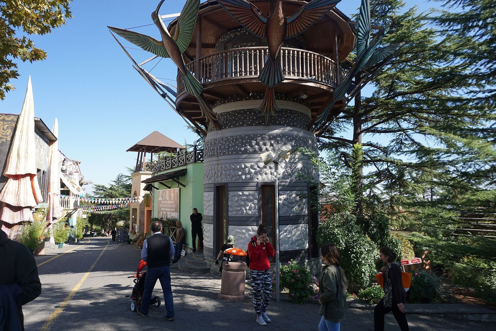
The walk ends at Mtatsminda Park, the amusement park on the summit. From there you can ride the funicular down for about 10 to 12 GEL plus a 2 GEL park card, or walk the paved 1.5 km path down past the graves of Georgia's writers at the Mtatsminda Pantheon. I'd walk; the church terrace halfway down has one of the quietest views in the city.
Kojori to Tbilisi: the best half-day hike
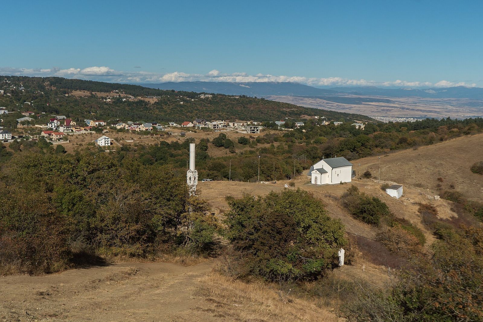
Kojori is a hilltop village about 16 km from the center, at roughly 1,350 m, on the ridge that closes off the southwest side of the city. Because it sits so much higher than Tbilisi, the classic route runs downhill: you ride the bus up, see Kojori Fortress, walk north through the forest to Udzo Monastery and a viewpoint over the whole city, then drop down past Mtatsminda back into town.
It takes 4 to 5 hours at a steady pace, plus whatever time you spend at the fortress and over lunch. The ground is a mix of forest paths, dirt roads, open clearings and a few rocky or muddy stretches, with some short, steep downhills. You need no special gear, just shoes with grip.
Getting to Kojori
Two city buses go up. Bus 380 leaves from Baratashvili Street, near Freedom Square; get off at the junction of Azeula and Vazha Pshavela streets, the closest stop to the fortress. Bus 316 runs toward Kiketi and stops on Kojori's main square, a 20 to 30 minute walk from the fortress on signed, marked paths.
Both run about every 40 minutes from 07:00 to 23:00, and the ride takes about 45 minutes. The 380 can be late or cancelled without notice, so if it doesn't show, take the 316. If you'd rather skip the bus, a Bolt ride from Freedom Square takes about 30 minutes and costs about 27 to 35 GEL.
Kojori Fortress
Kojori Fortress, also called Azeula, is a medieval ruin on a rocky crag at the south end of the village. From the main square it's a 20 to 30 minute walk, and if you only want the fortress, a round trip from the southern edge of town takes about an hour with around 100 m of climb. You go as much for the setting: grassy ridges falling away on all sides, with dirt tracks running along the range.
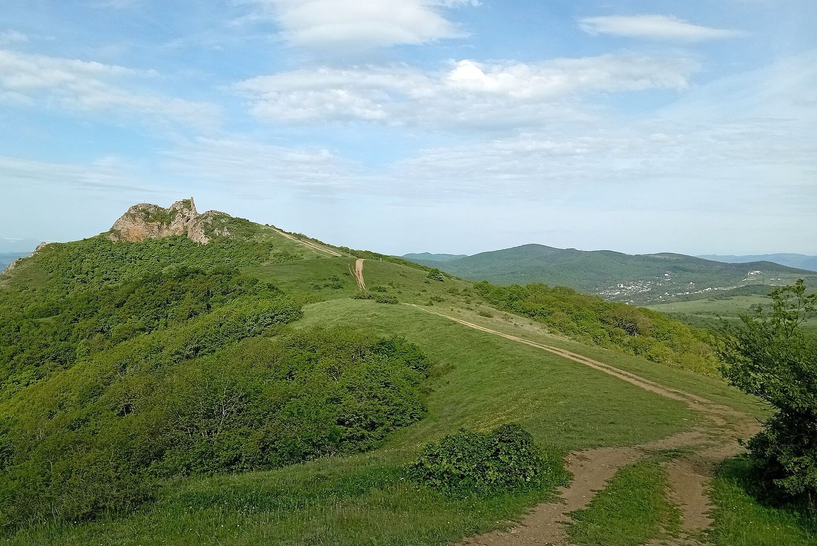
Kojori itself is worth 30 minutes before you set off. On the main square there's a terracotta bas-relief wall, and around town you'll find an abandoned Russian-style mansion that maps label as Beria's Summer House, and the former Pioneer youth camp with Soviet-era mosaics, which locals say is due to be demolished. See it while you can.
Udzo Monastery and the walk down
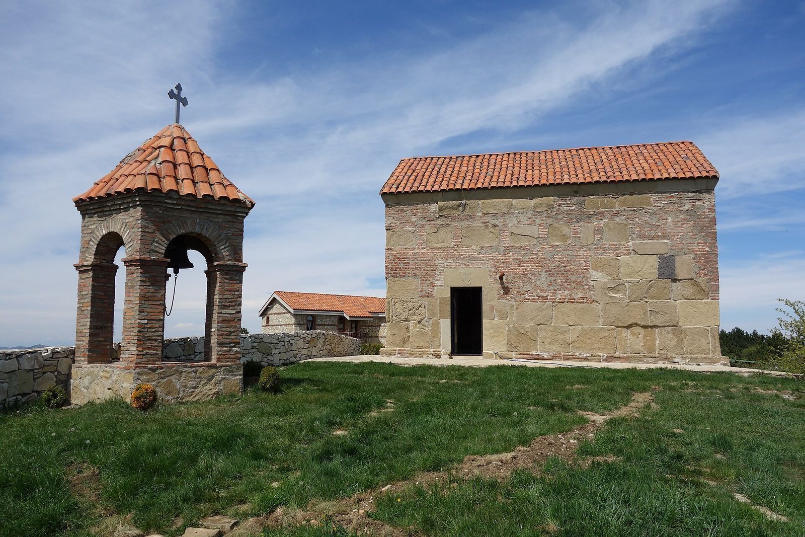
From the main square, Udzo Street heads north out of the village and into the forest. Udzo Monastery is about 3.5 km along it, a small church on a quiet hillside. About 500 m past the monastery is the viewpoint, and it's the highlight of the day: the whole city laid out below, Kumisi Reservoir to the south on a clear day, and sometimes the snowy Caucasus far to the north. It's my pick for lunch.
From the viewpoint, the trail carries on toward Mtatsminda. You can finish at the amusement park and ride down, or skip the park and walk down north of the TV tower to the church of St Michael of Tver on Polikarpe Kakabadze Street. That route ends at the crossroads of Mtatsminda and Kakabadze streets, at the foot of the Pantheon, a short walk from Sololaki's cafes. Marked side trails also branch off toward Turtle Lake and down to Vake or Vera.
Other routes from Kojori
Kojori anchors several walks, and the same 1 GEL buses serve all of them.
| Route | Length and time | What it's like | Getting back |
|---|---|---|---|
| Kojori to Tbilisi via Udzo | 4 to 5 hours | Mostly downhill, forest and viewpoints | You walk into the city |
| Kojori to Kiketi | About 7 km, 2 to 3 hours | Flat or downhill, past waterfalls | Bus from Kiketi |
| Mtatsminda Park up to Kojori | About 10 km, about 4 hours | A steady climb all the way | Bus 380 or 316 down |
| Kojori Fortress only | About 1 hour return, about 100 m of climb | Short and steep | Bus 380 or 316 |
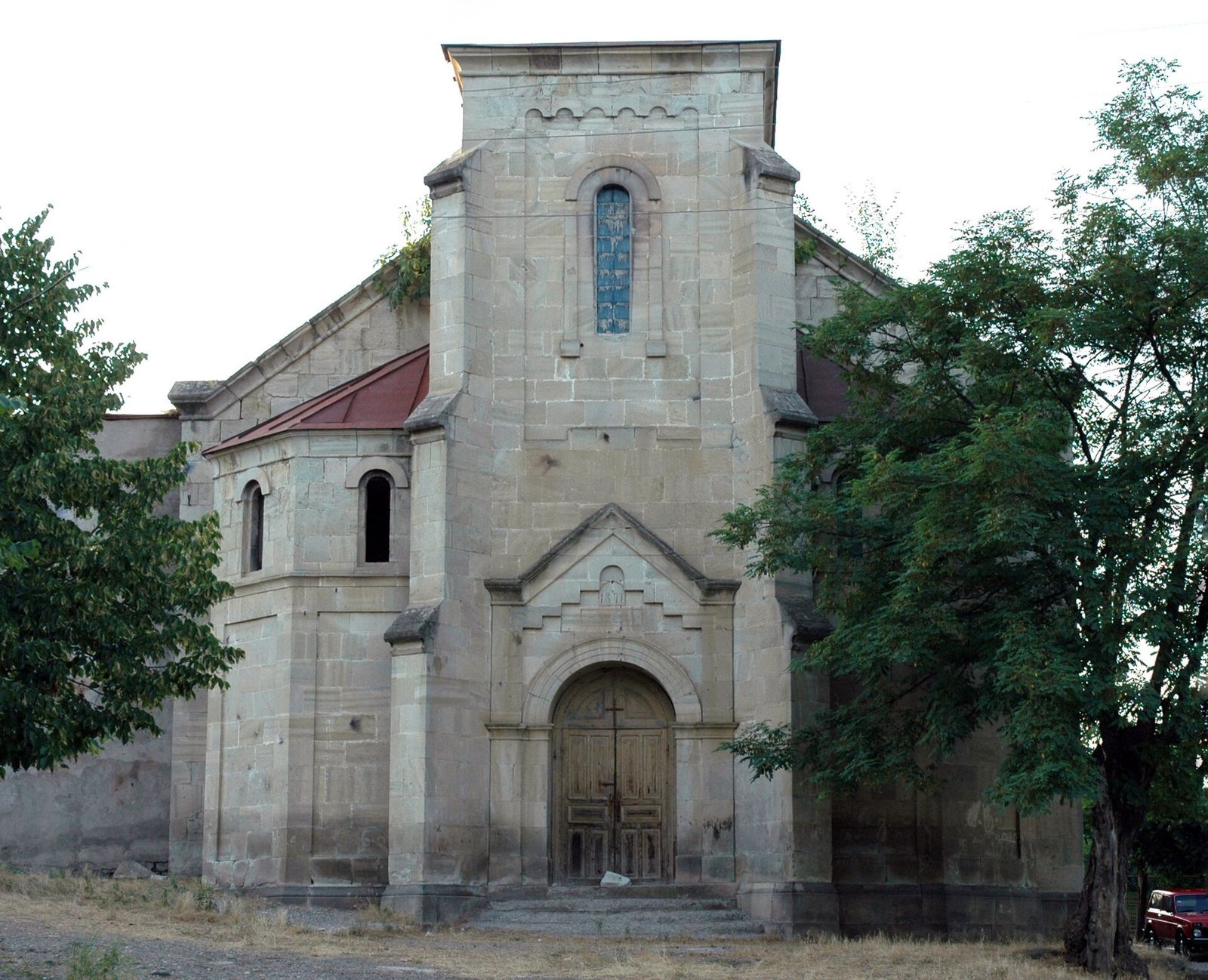
The other well-known option is Kojori to Asureti, the old German settlement, a gentle walk with only a couple of real climbs. Sort out your ride back from Asureti before you set off, since it sits off the Kojori bus line.
Tbilisi National Park hikes
Tbilisi National Park covers the forested Saguramo range north of the city, between Tbilisi and Mtskheta, and it was set up in 1973. It's where you go for a real day in the woods: beech forest, open meadows and long ridges. The trails open to visitors are marked and carry information boards, and several picnic areas have fire pits, benches, tables and restrooms.
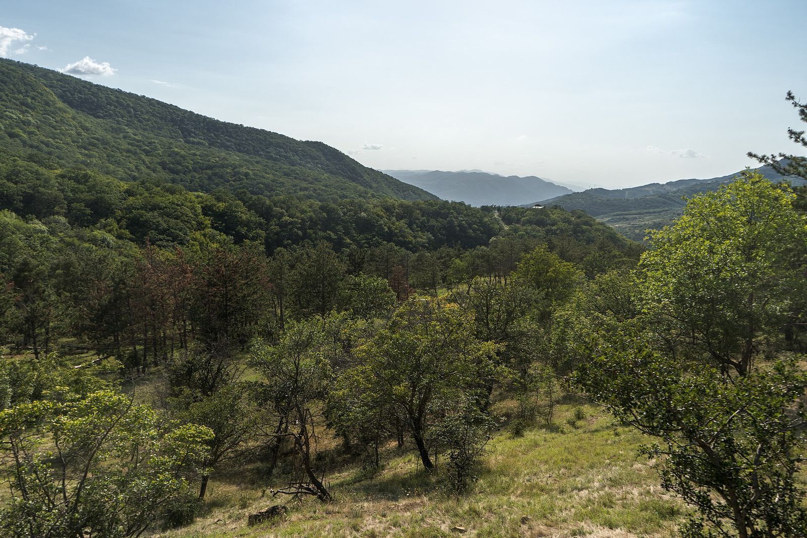
The catch is access. The park is about a 45-minute drive from the center and there's no direct public transport, so plan on a taxi or Bolt for about 30 to 40 GEL. Agree the return with your driver, or make sure your phone has data to call a car from the trailhead.
Saguramo Ridge
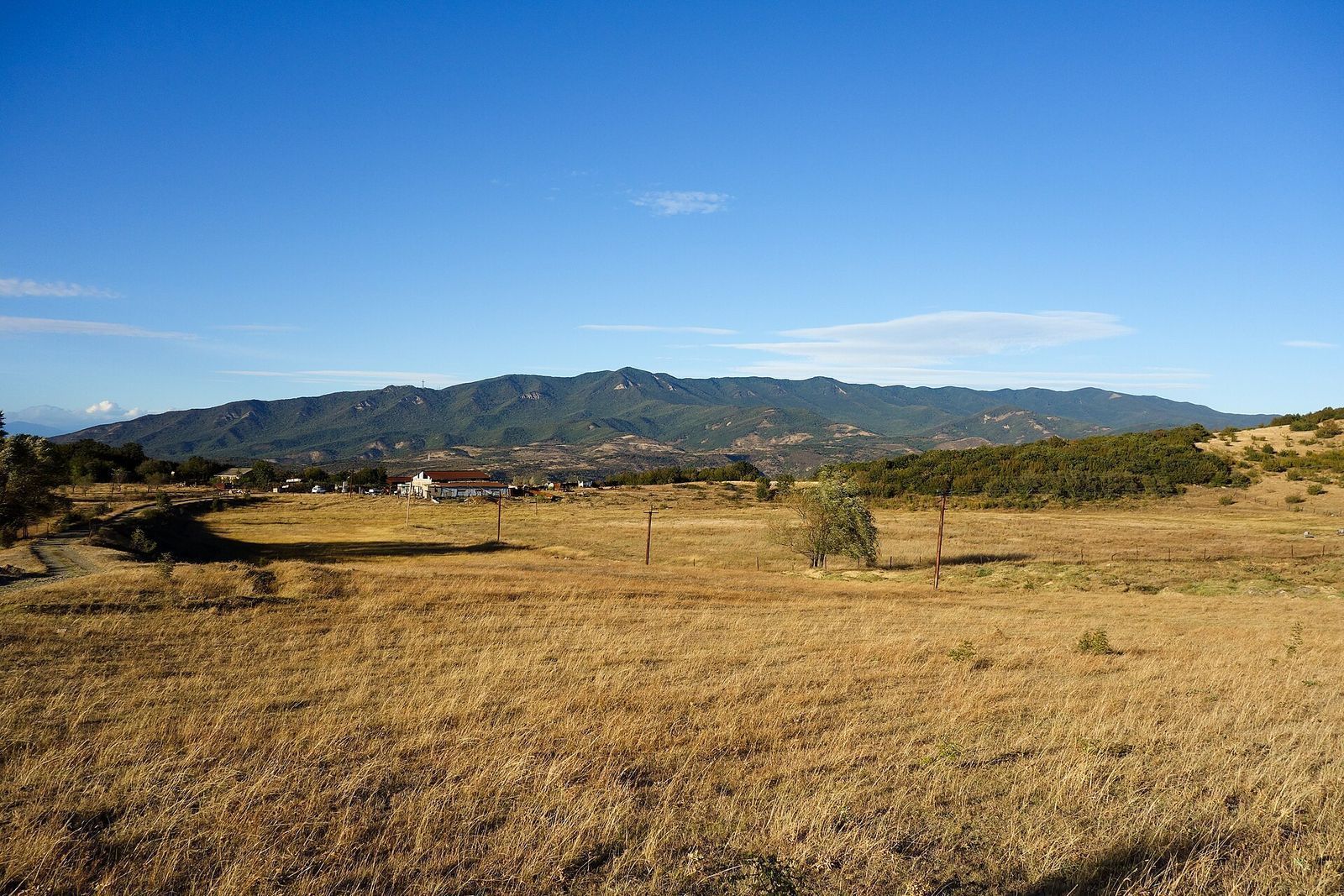
This is the one I'd do first. The Saguramo Ridge trail is about 11 km round trip and takes 4 to 5 hours, or 6 to 7 hours door to door with the drive. It mixes forest with open paths along the ridge, and a few steep sections pay off with wide views over the hills. It asks more of you than Kojori, but nothing technical.
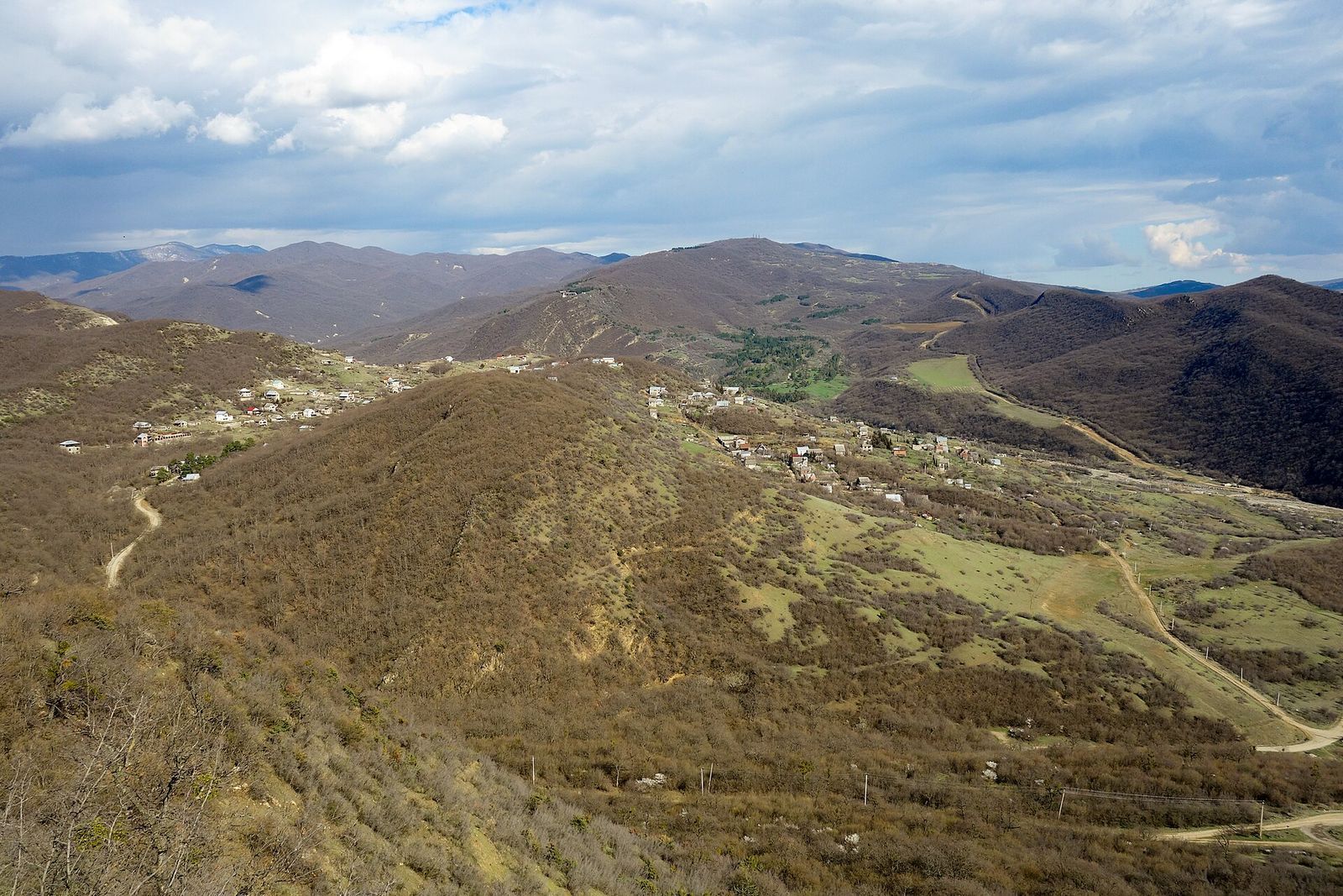
Another marked trail runs from Mamkoda village through the Vegini Valley and Didveli to Saguramo. You can walk it in a day, and there's a camping area along the way if you want to split it.
Mamkoda to Zedazeni Monastery
This is the harder day, about 15 km and 5 to 6 hours of walking, or about 8 hours with the drives. The route is marked with white-red-white blazes, but on the ground there is often no path at all, just thick grass and bushes, with patches of stinging nettle. Wear long pants and waterproof shoes, and carry an offline map.
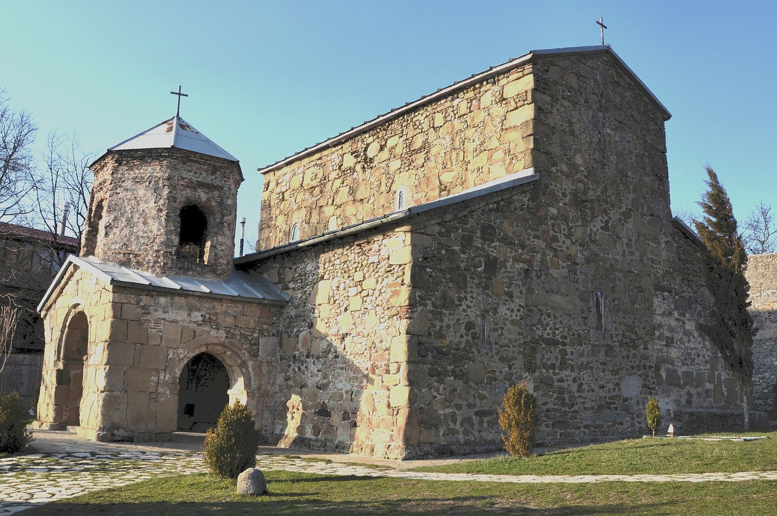
I'd order a Bolt straight to Zedazeni Monastery and walk it toward Mamkoda. The monastery sits at about 1,170 m on its own mountain northeast of Mtskheta, founded in the 6th century by St John of Zedazeni, and you get the church at the start while your legs are fresh. Mamkoda is only about 6 km from Gldani on the city's northern edge, so the ride home at the end is short. Very fit hikers start in Gldani and walk the whole way to Zedazeni, which turns it into an 8 to 10 hour day with transport.
Martkopi tower
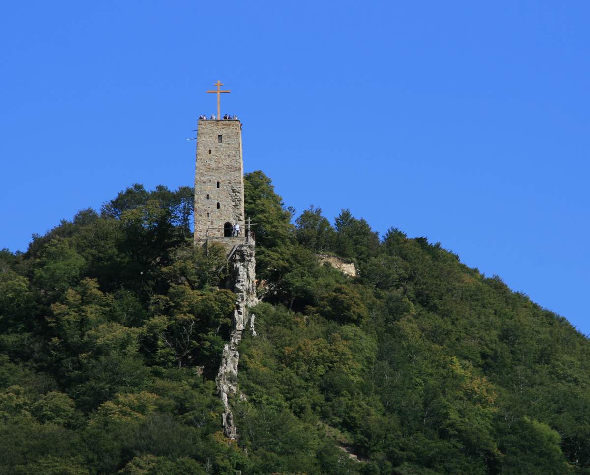
If you want the view without the hike, Martkopi is about 30 minutes east of the city by car. A walk of about 15 minutes takes you up to the tower, which looks down on Martkopi Monastery in the middle of the forest. It pairs well with a lazy afternoon.
Shaori Fortress hike
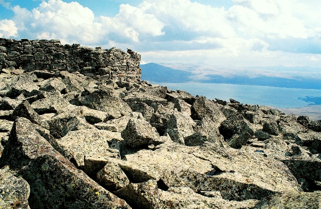
Shaori is the one people call Georgia's Stonehenge, and the name fits better than "fortress". It's a crown of huge cyclopean boulders on a ridge at about 2,750 m in Samtskhe-Javakheti, above Paravani Lake, and nobody agrees whether it was an observatory or a pagan shrine. A path of flat basalt slabs leads up to the stones, laid long before Georgia had a written history.
The trip is a long one. It's about 132 km and roughly 2 h 50 each way by road, through the Algeti gorge and Tsalka, then past Paravani Lake and Tambovka, a village of Doukhobor cottages on its shore. The hike itself is short, about 5 km with around 390 m of climb, but the altitude, the rocky scree and the wind make it feel harder than the numbers. A guided trip runs about 9 hours door to door.
What you get at the top is a 360-degree view of volcanic cones and Paravani Lake, and chips of black obsidian glinting in the path on the way down. I'd go in summer or early autumn, on a clear day, and I'd go guided.
Tskhrajvari: a Kutaisi hike, not a Tbilisi one
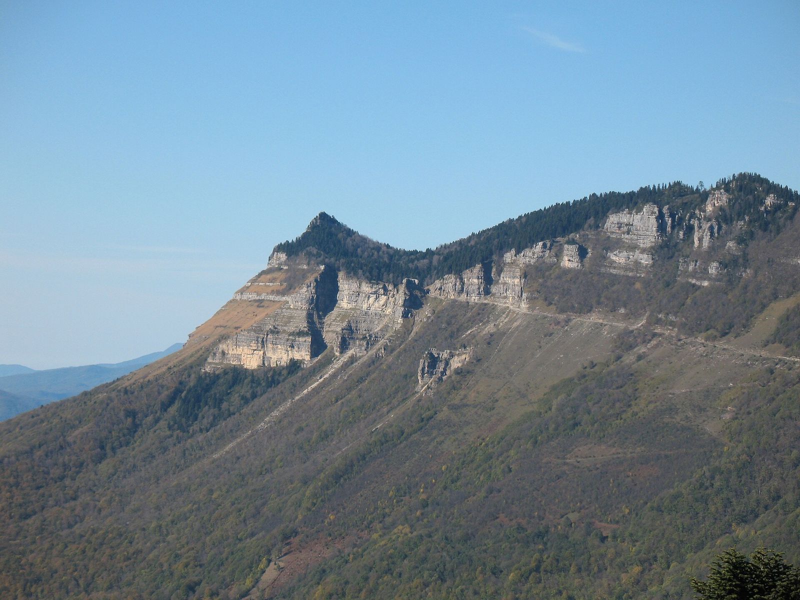
Tskhrajvari means "nine crosses", and it's a shrine on a cliff top near the Nakerala Pass, on the road between Tkibuli and Ambrolauri where Imereti meets Racha. It's about an hour's drive from Kutaisi. From Tbilisi you'd first cross most of the country, so plan it for your days in the west, not as a day hike from the capital.
From the pass it's about 3 km in total: 1 km of dirt road, then roughly 2 km of trail of moderate difficulty along the cliff edge. The walk starts at the car park by an abandoned Soviet cable car station. Wooden stairs were added in 2022, and several sections are now damaged, so watch your footing. The top sits at roughly 1,500 to 1,590 m, and on a clear day you see across the Colchis lowlands to the Black Sea, with the snowy Caucasus behind you.
Go between June and October, on a clear day, and never after rain. Fog rolls in fast up there and can sit for hours, and the cliff path is no place to be in it. Day tours from Kutaisi pair the hike with Shaori Lake and Nikortsminda Church. That Shaori is a reservoir in Racha, not the stone fortress in Javakheti, which confuses a lot of people planning both.
Hikes on the classic day trips: Jvari, Gergeti, David Gareja and Borjomi
Several of the best day trips from Tbilisi have a walk built into them, and if you're doing the trip anyway, the walk is often the best part.
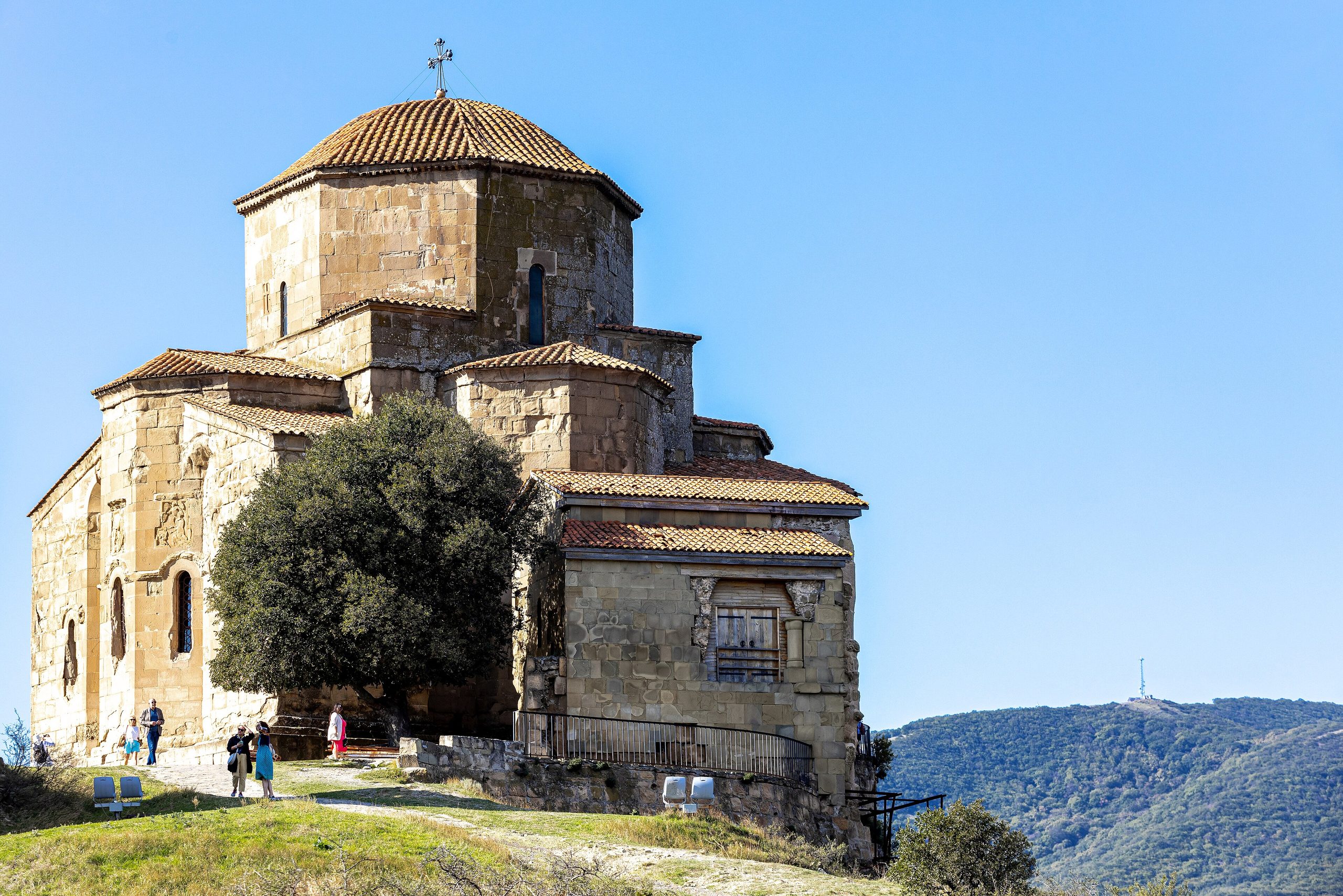
Jvari Monastery, Mtskheta. No bus goes up to Jvari, and the footpath up the hill is steep. Most people take a taxi from town for about 15 GEL one way and then walk the rest of the Mtskheta day trip downhill on foot, from the cathedral to the old town. It's a stroll, not a hike, but a good one.
Gergeti Trinity Church, Kazbegi. The walk up to Gergeti takes about 1.5 hours through forest and open meadow, with roughly 500 m of climb, and coming down is quicker. The 4x4s that wait in Stepantsminda cost about 30 to 50 GEL per car return if you'd rather ride.
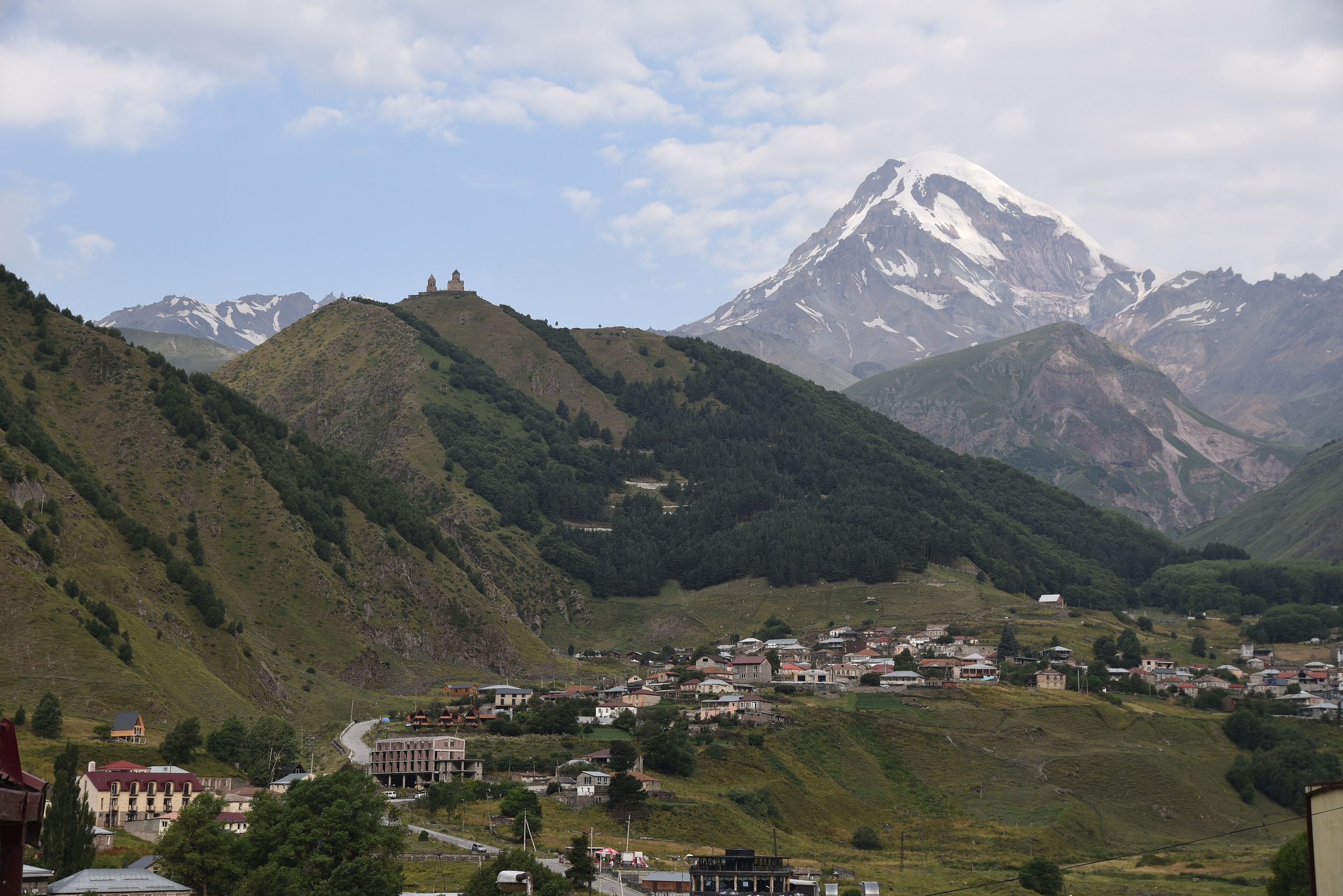
Kazbegi is 2.5 to 3 hours each way from Tbilisi, so a hiking day there is a 12-hour day. The Kazbegi day trip works with the Gergeti walk if you leave early, but the bigger hikes, the Gergeti Glacier (4 to 6 hours return, with a guide) and Truso Gorge (a full day), need a night in Stepantsminda.
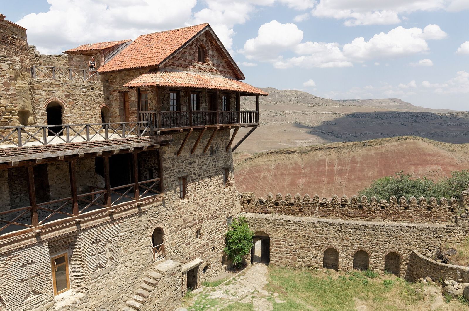
David Gareja. The famous ridge walk from Lavra up to the Udabno cave churches has been closed since 2019, and border guards turn walkers back. What's left is a 30 to 60 minute wander over the striped Rainbow Hills near Udabno village. David Gareja is still a fine day out, but don't go expecting a hike.
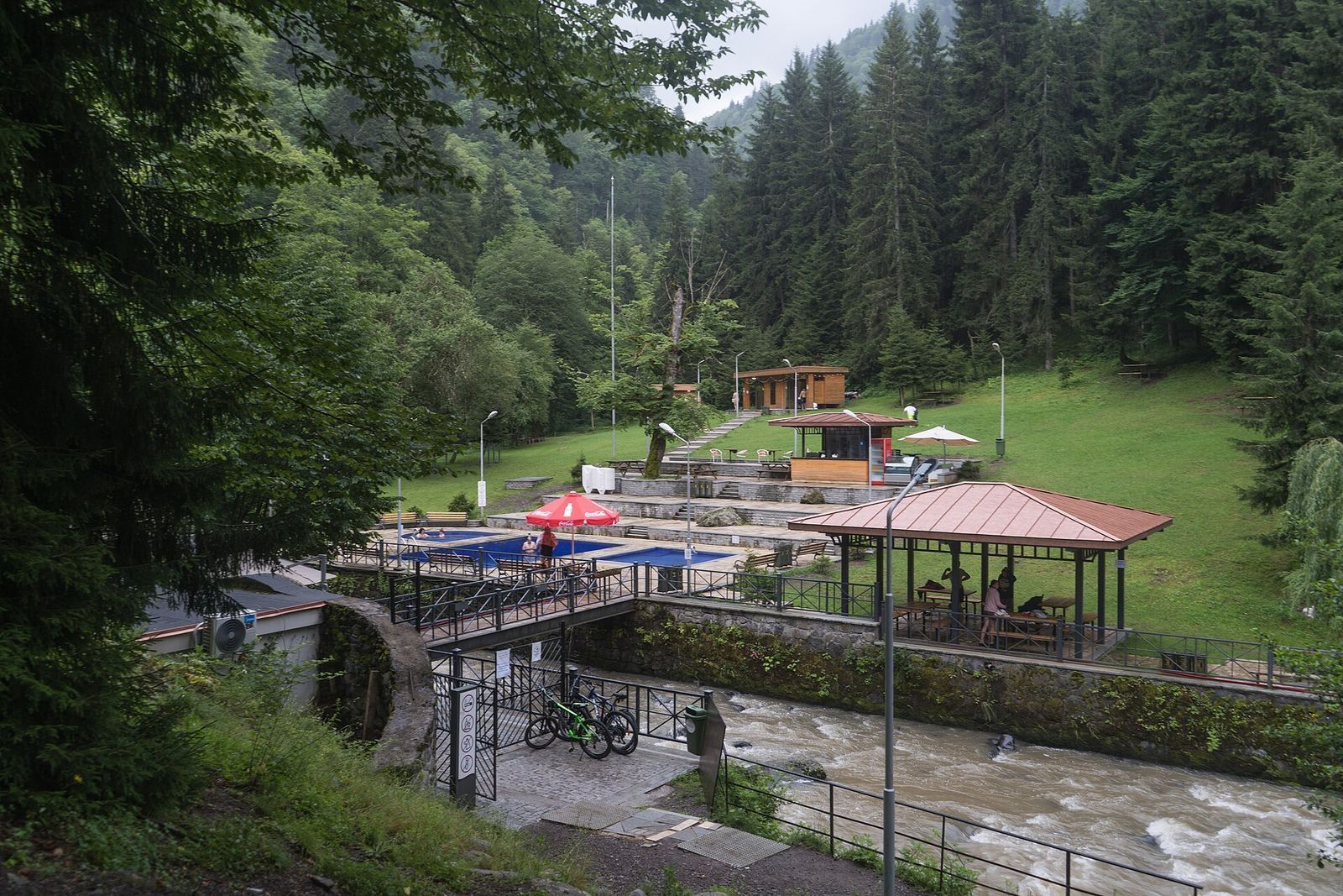
Borjomi. About 150 km west, Borjomi has the gentlest walking day of all: through the 19th-century park and along a forest path to the open-air sulfur pools, about 8 or 9 km there and back. The national park trails beyond the town need an overnight in Borjomi to do properly.
Best time of year to hike near Tbilisi
Spring and autumn are the seasons I'd plan around. The Kojori route works year-round, but the high hikes have a short window.
| Season | Close hikes (Kojori, Turtle Lake, the national park) | High hikes (Shaori, Tskhrajvari, Gergeti) |
|---|---|---|
| Spring | Green forest and wildflowers; the best season | Snow lingers up high; Tskhrajvari is best from June |
| Summer | Tbilisi is very hot; start early, and Kojori runs cooler than the city | The main season; go on clear days |
| Autumn | Golden beech forest and mild days; my favorite | Good into October, on clear days |
| Winter | Snow and ice at Kojori; shoes with real grip | Mostly off; the Kazbegi road can close beyond Gudauri |
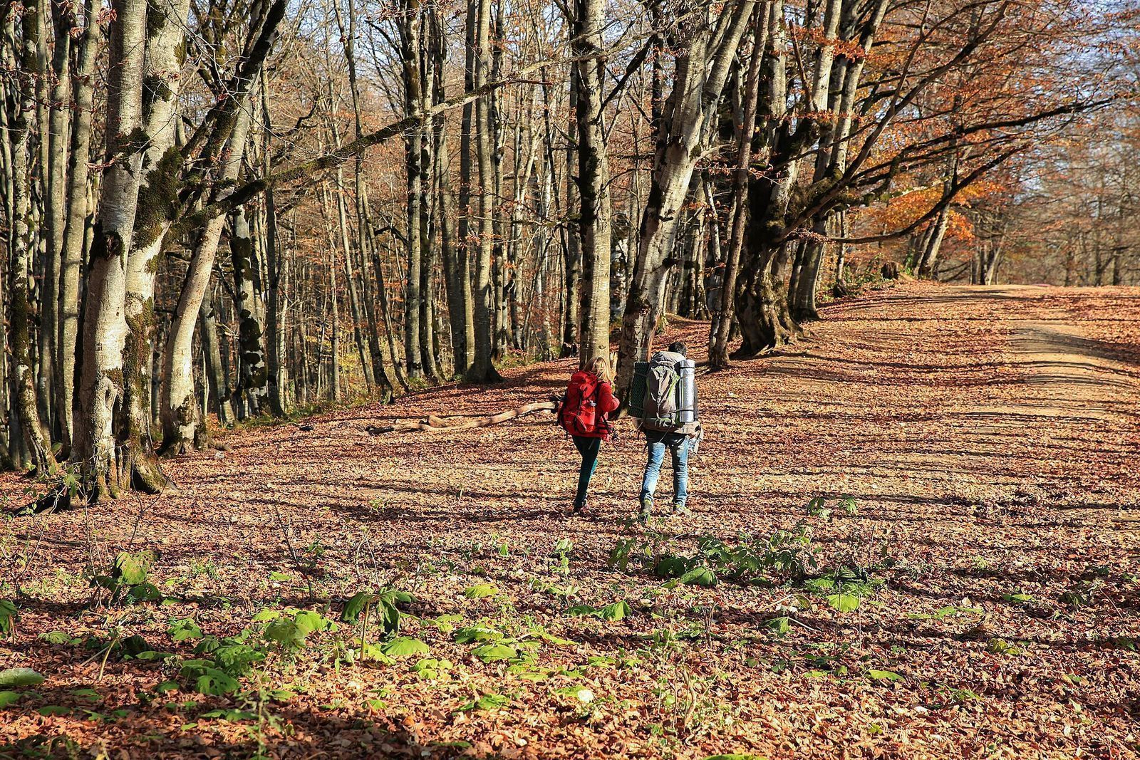
Autumn is when the beech forests in the national park turn copper and gold, and it pairs well with everything else that makes Tbilisi in autumn the easiest season to love. In summer, do Kojori and the national park in the morning and leave the afternoon for a long lunch in the city.
What to bring and how to stay on the trail
None of these hikes needs technical gear, but each one goes better with the right few things in your bag:
- Shoes: trainers with grip are fine for Kojori and Turtle Lake. For Mamkoda to Zedazeni and Shaori, wear waterproof boots, and long pants against the nettles.
- Water and lunch: buy them on Kojori's main square before you set off. I wouldn't count on buying anything once you're inside the national park.
- Layers: a hat, gloves and a warm layer from late autumn to spring, a raincoat when the forecast is mixed, and sunscreen and a sunhat in summer.
- Transport card: a Metromoney card for the Turtle Lake cable car, and Metromoney or a contactless bank card for the Kojori buses.
- Offline maps and data: Maps.me or Mapy.cz with the Georgia map downloaded, plus a Georgian SIM or eSIM so you can call a Bolt from a trailhead.
Be off the trail before dark. None of these paths is lit, and the forest above Mtatsminda gets dark well before the city below it does.
Key takeaways
- Kojori to Tbilisi is the best first hike: a 1 GEL bus up, 4 to 5 mostly downhill hours, and you walk back into the city.
- Turtle Lake to Mtatsminda is the easiest hike to fit around a city day, about 3 hours from the cable car to the TV tower.
- Tbilisi National Park needs a 30 to 40 GEL taxi but gives you the wildest walking within an hour of the center.
- Shaori Fortress is a long, guided day; Tskhrajvari belongs to a Kutaisi trip, not a Tbilisi one.
Frequently asked questions
Can you go hiking from Tbilisi without a car?
Yes. Buses 380 and 316 take you to the Kojori trailheads for 1 GEL, and the Turtle Lake cable car starts the ridge walk to Mtatsminda for 1 GEL. Tbilisi National Park, Shaori Fortress and Martkopi need a taxi, a driver or a tour.
What is the easiest hike near Tbilisi?
Kojori to Kiketi is the easiest: about 7 km, 2 to 3 hours, and mostly flat or downhill past waterfalls. Turtle Lake to Mtatsminda is just as easy and needs no bus at all.
How do I get to Tbilisi National Park?
Take a taxi or Bolt, about 45 minutes from the center for about 30 to 40 GEL. There's no direct public transport. For the Zedazeni trail, order the car straight to Zedazeni Monastery.
How long is the Kojori to Tbilisi hike?
It takes 4 to 5 hours at a steady pace, plus time for the fortress and lunch. Udzo Monastery is about 3.5 km from Kojori's main square, and most of the route after that is downhill to Mtatsminda.
Can you visit Shaori Fortress as a day trip from Tbilisi?
Yes, but it's a long one: about 2 h 50 each way by road to Samtskhe-Javakheti, above Paravani Lake, and about 9 hours in total. The hike itself is about 5 km with 390 m of climb on an unmarked trail, so go with a guide.
Is Tskhrajvari near Tbilisi?
No. Tskhrajvari is near the Nakerala Pass between Tkibuli and Ambrolauri, about an hour's drive from Kutaisi. Do it from Kutaisi, between June and October, on a clear day.
When is the best time to hike near Tbilisi?
Spring and autumn are best, with mild days, green or golden forest and clear views. Summer works if you start early, and the high hikes like Shaori and Tskhrajvari are best between June and October.
Do I need a guide to hike near Tbilisi?
Not for Kojori, Turtle Lake or Saguramo Ridge, as long as you carry an offline map. A guide is worth it for Shaori Fortress, where there is no marked trail, and helps on Mamkoda to Zedazeni, where the path often disappears.
12 Best Day Trips from Tbilisi, With Prices and Timings
Tbilisi is known for its easy day trips. Here are the 12 best, how to reach each one and what a day out costs.
Read the guideMtskheta Day Trip from Tbilisi: Jvari, Svetitskhoveli and Getting There
Mtskheta is the easiest day trip from Tbilisi. Here is how to get there, what to see and how to fit it in half a day.
Read the guide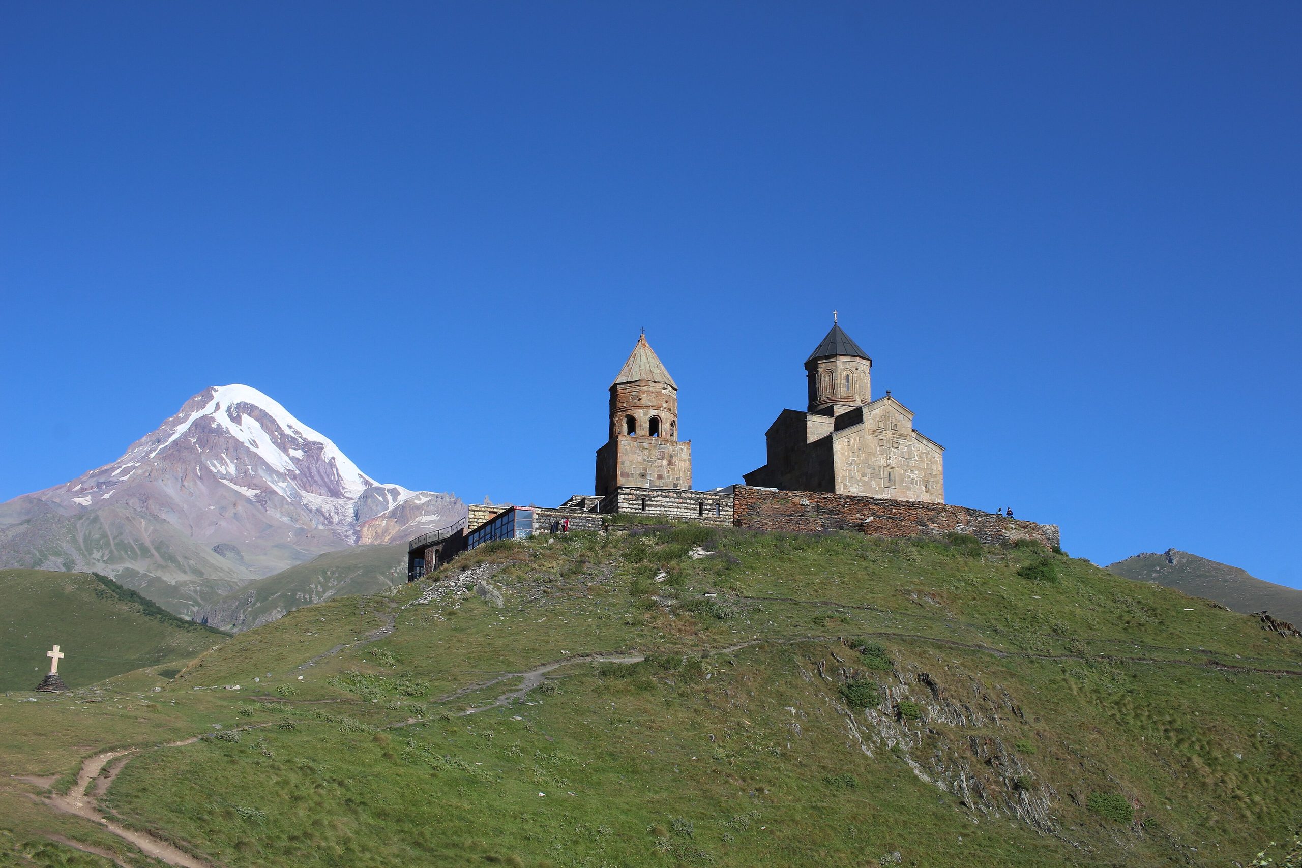
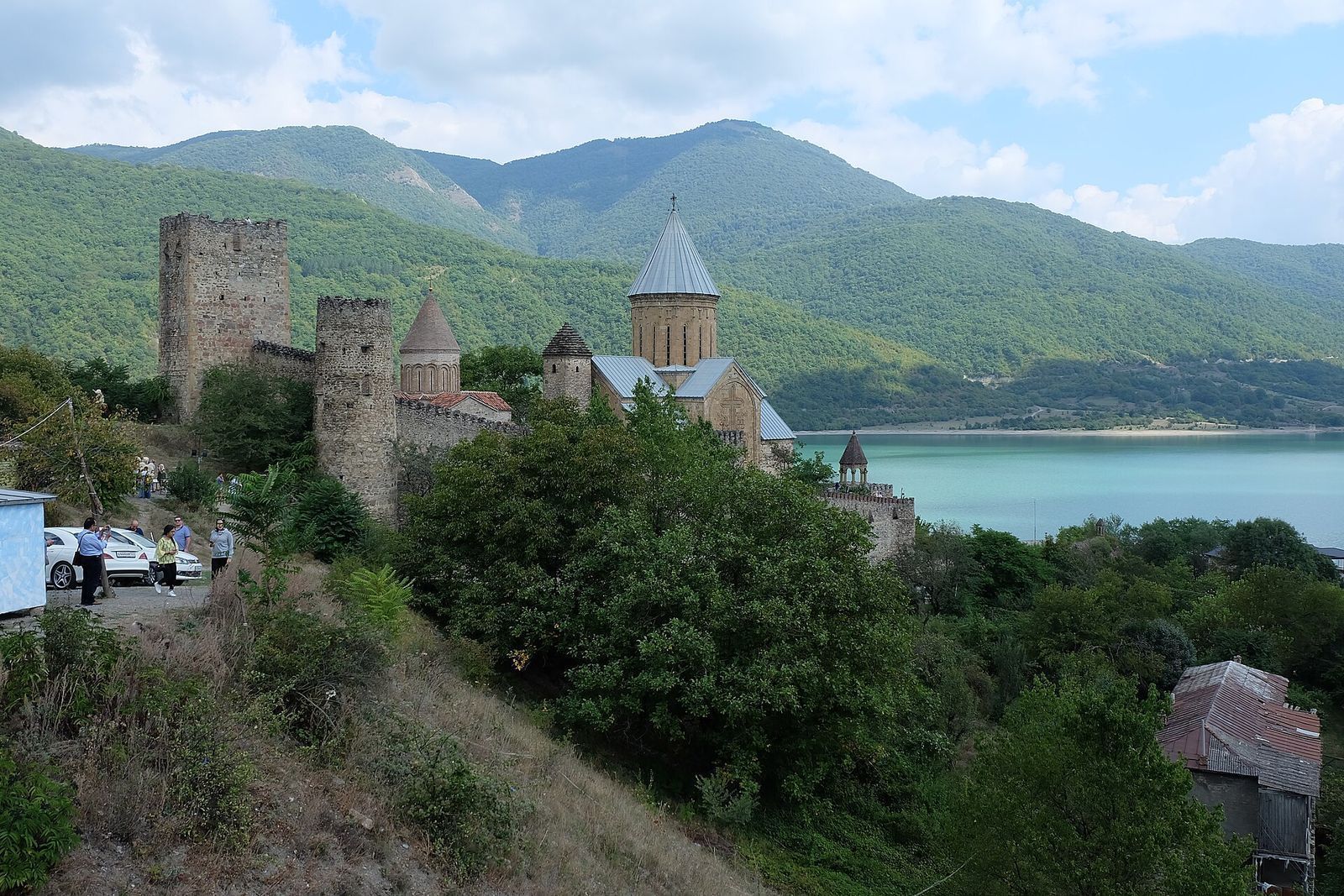
Kazbegi Day Trip from Tbilisi: Gergeti, Ananuri and the Military Highway
Kazbegi is the classic mountain day trip from Tbilisi. Here is the route, the stops, the costs and how to time it.
Read the guide